Description
Accommodation
Features
BER Details
Directions
Viewing Details
Show more...
| Beds | |
| Price | Sold |
| Property Type | |
| Size | meters2 |
| Energy Rating | BER- |
| Refreshed on | |
| Eircode |
Description
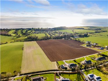
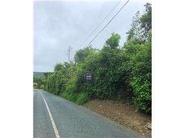
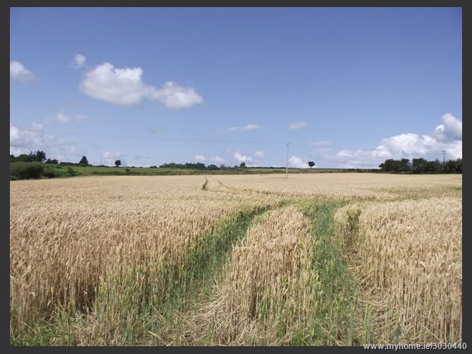
c. 19.15 acres of ground with two derelict dwellings at Ballyduff, Ashford, Co. Wicklow. The land comprises c. 19.15 acres ( 7.75 Hectares) in total with direct road frontage (c. 200m) onto the main road at Ballylusk.
Accommodation
The derelict dwellings are located to the center of the land and both front directly onto the road. Both properties have not been occupied for a number of years and comprise external walls in disrepair with little or no roof structure. Due to the condition of both buildings and the length of time since in residential occupation any future development would be subject to planning permission and it is expected that and planning permission may be subject to local authority planning restrictions. The land which is currently under a tillage crop of wheat is situated around the derelict buildings and is laid out in two large divisions. Some of the land has been recently reclaimed and re-seeded. Boundaries are clearly defined and made up of a mix of ditches, hedging and stock proof fencing. The surrounding area is predominantly in agricultural use with a low-density, one-off rural housing mainly linked to the agricultural community.
Features
c.19 Acres of good quality land with two former residences Extensive road frontage c. 200 onto main road at Ballyduff, Ashford, Co. Wicklow. The land is situated c. 100m from Ballyduff crossroads. c. 10km to Ashford and N11 roadway
BER Details
BER: BER No. XXX Energy Performance Indicator: XXX kWh/m²/yr
Directions
The land is ideally situated in a wonderful picturesque setting c 10km to Ashford village c. 7km to Newtownmountkennedy and c. 6km to Roundwood. Coming from Dublin in the village of Ashford take the right at the Ashford House roundabout, at the next junction stay right onto R764 stay on this road for approx 6.5km the land is on the right hand-side marked by a signboard. RGPS Co-ordinates 53° 2'51.45"N 6° 9'10.27"W
Viewing Details
By appointment only
Date created: Dec 12, 2014