Description
Features
Show more...


| Beds | |
| Price | POA |
| Property Type | Development Land |
| Size | meters2 |
| Energy Rating | BER- |
| Refreshed on | |
| Eircode | |
| Group Name | French Estates |
| Sales License Number | 002373 |
Description
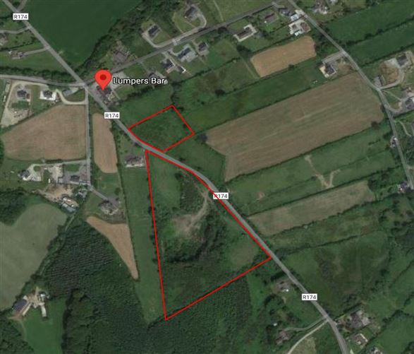
The subject lands comprise of an existing stone quarry for the production of road making and aggregate materials. The site is triangular in shape and comprises an area of c. 3.6 hectares / 10 Acres. It benefits from approximately 300m of road frontage. Location The subject land is located on the Cooley Peninsula approx. 3 km south of Ravensdale, 6 km north-east of Dundalk and to the west of Regional Road No. R174. It is sited at the base of Drumenagh Hill at the foot of the Cooley Mountains The N52 is located approx. 7km from Ballymakellett which links the M7 and the M1. The route forms a connection between the north east of Ireland and the mid west traversing the midlands. The M1/N1 which is the main Belfast to Dublin road is accessible within 8 minutes of the subject land. The subject land is located approx. 7 km from Junction 18 of the M1 Motorway via R173/4. The proposed haulage route is directly onto the R174 and southwards via the R173 and onto the M1 motorway. Geological Survey Geological Surveys available on request. Planning The subject land has been granted permission to re open the existing stone quarry, pre 63. Planning Reference: Louth County council : 18226 An Bord Pleanala : 303150 Drive Time From Ballymakellett M1 ⇒ 7 min / 7 km Carrickdale ⇒ 10 min / 9 km Dundalk ⇒ 15 min / 11.5 km Blackrock ⇒ 18 min / 15 km Newry ⇒ 20 min / 19 km Belfast ⇒ 55 min / 79 km Dublin ⇒ 1hr 5 min / 97 km
Features
● An opportunity to acquire a “Ready to Go” operational existing stone quarry for the production of road making and aggregate materials ● The site is located in Ballymakellett ● Site traverses both sides of the R174 ● Easy access to M1/N1/N52 ● Excellent location
Date created: Jul 20, 2021